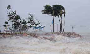
Tropical Cyclone Megan has made a formidable landfall along the coastline of Australia’s Northern Territory, unleashing its fury with wind gusts reaching up to 200 kilometers per hour (124 mph), accompanied by heavy rainfall and menacing storm surges across the sparsely populated region.
The cyclone struck the Australian mainland late on Monday, near the remote town of Borroloola on the southwestern edge of the Gulf of Carpentaria, after having relentlessly battered island communities in the preceding days. However, as it approached the mainland, the cyclone notably weakened, alleviating concerns of catastrophic winds and widespread flooding that had loomed over a string of remote settlements.
Plans for the evacuation of approximately 700 residents in Borroloola were initially put in motion before the cyclone’s landfall, yet were subsequently called off due to adverse storm conditions impeding Australian Defence Force aircraft from landing safely. Instead, residents were advised to seek refuge in designated safe havens such as the police station, health facilities, or other sturdy structures capable of withstanding the cyclone’s powerful gusts.
Similarly, evacuation efforts at the McArthur River Mine were halted due to the precarious weather conditions. Meanwhile, Groote Eylandt experienced a deluge of almost 600 mm of rainfall over the weekend as the cyclone traversed over remote Gulf of Carpentaria island communities, resulting in toppled trees and flash flooding incidents.
In the midst of the chaos, the wharf servicing the GEMCO manganese mine on Groote Eylandt suffered damage from one of its vessels carrying valuable cargo. Fortunately, authorities confirmed that there was no spillage, and efforts were underway to dislodge the ship from the damaged wharf.
Looking ahead, the forecast predicts Tropical Cyclone Megan to continue its trajectory further inland towards the southwest on Tuesday, gradually diminishing into a tropical low by morning. However, this transition is expected to bring continued heavy rainfall and the potential for flash flooding to parts of the Carpentaria region. The Australian Bureau of Meteorology has warned of rainfall totals of up to 200 mm over a 24-hour period, accompanied by wind gusts exceeding 90 kph (56 mph) in the affected areas.
The occurrence of Tropical Cyclone Megan adds to a series of recent cyclonic events in Australia. In December, Tropical Cyclone Jasper marked the onset of the Australian cyclone season, unleashing its wrath upon the northern Queensland coast. Similarly, in January, the devastating impact of Tropical Cyclone Kirrily left thousands without power for days as it ravaged coastal communities with wind gusts of up to 170 kilometers per hour (106 miles per hour) in the same region.


